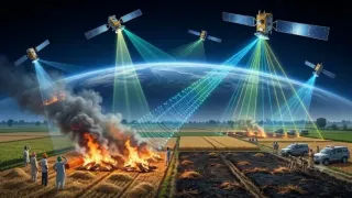
The timing of stubble burning in Punjab and Haryana is emerging as a major challenge for satellite-based monitoring, with farmers allegedly setting fields ablaze after conventional satellites have passed overhead.
The tactic has drawn comparisons with India's 1998 Pokhran nuclear tests, when scientists, including Dr APJ Abdul Kalam, concealed preparations from American surveillance satellites. Nearly three decades later, the challenge is to detect farm fires that escape brief satellite observation windows.
A new platform, Fire Watch, launched by the International Forum for Environment, Sustainability and Technology (iFOREST), aims to address this gap by tracking active fires, their timing and the total agricultural area burnt.
“Current monitoring relies on fire counts from polar-orbiting satellites, which give an incomplete picture of stubble burning,” NDTV quoted Dr Chandra Bhushan, CEO of iFOREST.
“To design effective interventions, we need to know not only how many fires are detected, but also where and when burning takes place and how much land is affected. Fire Watch brings these data together to make better information available to policymakers and the public.”
Why Are Satellite Systems Missing Farm Fires?
Normal monitoring typically involves using the MODIS sensors aboard NASA's Terra and Aqua satellites, and VIIRS sensors on the Suomi-NPP and NOAA-20. These satellites do not monitor locations continuously, but rather at predetermined time intervals.
According to the iFOREST 2025 Stubble Burning Status Report, over 90 per cent of large farm fires in Punjab in 2024 and 2025 have taken place after 3 pm, as opposed to just 3 per cent in 2021. In Haryana, the majority of large fires have been taking place after 3 pm since 2019.
This indicates that a monitoring system based on mostly daytime satellite passes could miss a large proportion of burning.
How Does Fire Watch Work?
Fire Watch combines three types of satellite observations to provide a broader picture of stubble burning.
-Active fire detection: MODIS and VIIRS data identify the location of detected fires.
-15-minute monitoring: Meteosat-8 and Meteosat-9, carrying SEVIRI instruments, provide repeated observations of the same region approximately every 15 minutes, helping track when burning activity peaks.
-Burnt-area assessment: Sentinel-2 imagery compares land conditions before and after the burning season to estimate the agricultural area affected.
The platform currently covers Punjab, Haryana, Uttar Pradesh and Madhya Pradesh, with plans to expand to more states.
Why Fire Counts Alone Do Not Tell The Full Story
The number of satellite fire detections does not necessarily represent the number of individual fires or the total area burnt. The same burning event may be detected more than once, while smaller, short-lived or cloud-obscured fires may go unnoticed.
This distinction is central to the new monitoring approach. Fire Watch combines active-fire detections with burnt-area estimates and the timing of observed activity, allowing policymakers to assess the problem beyond daily fire counts.
The issue also raises questions about India's monitoring system. A 2026 Parliamentary Standing Committee had earlier identified the deficiencies in satellite-based observations of forest fires and other environmental phenomena, and had called upon the Department of Space to fast-track development of a domestic geostationary satellite for continuous detection of such events.
The destruction is not immediately visible when the satellites capture only smouldering stubs, but the remains can be seen later. Using satellite imagery (including Cartosat-3 images), the National Remote Sensing Centre (NRSC), located in Hyderabad, assesses the affected farmland for burned patches, also known as burn scars.
The more difficult part is to determine the scale of stubble burnt rather than infer a figure based solely on the number of fires seen over satellite passes.