- By Aditi Priya Singh
- Thu, 24 Apr 2025 02:30 PM (IST)
- Source:JND
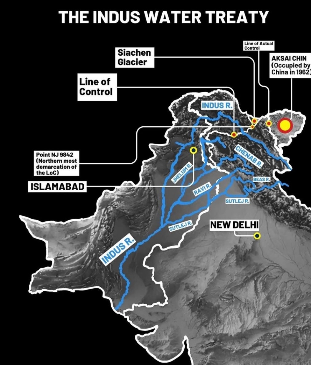
Indus River Origin And Map Location: The Indus river is one of Asia's most significant and longest rivers. It holds a special significance geographically, historically and culturally as it flows through various landscapes, cultures and nations. In wake of the devastating terrorist attack in Pahalgam, Jammu and Kashmir, on April 23, 2025, which killed 26 tourists, India has taken the unprecedented decision to halt the Indus Waters Treaty with Pakistan.
This treaty was established in 1960 and brokered by the World Bank. It had long been a symbol of cooperation between the two nations, even amidst periods of conflict. India's demand that Pakistan stop supporting cross-border terrorism is reflected in the decision to suspend it. The Cabinet Committee on Security, led by Prime Minister Narendra Modi, announced this move as part of a series of retaliatory measures, including the closure of the Attari-Wagah border and the expulsion of Pakistani diplomats.
Let’s explore its complete journey from its origin in Tibet to its final destination in Pakistan.
Origin of the Indus River
 Indus River origin (Image: Instagram)
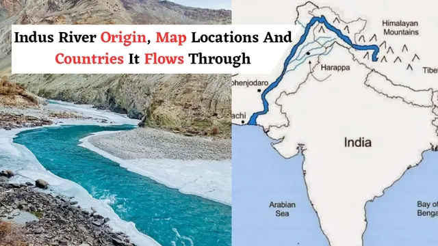
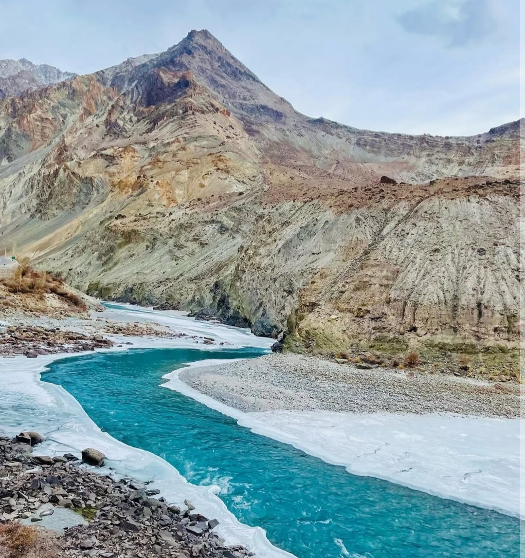
The Indus River originates on the Icy lands of the Tibetan Plateau in western Tibet (China), close to Lake Mansarovar and Mount Kailash. Buddhism, Jainism, and Hinduism all regard this region as sacred. At a height of roughly 18,000 feet, the river starts its journey and flows to the northwest. The Indus travels over 3,000 kilometres, nourishing land, people, and history along the way.
Map Location and Route of the Indus River: Which countries does it pass through?
The Indus River flows across three major regions of Asia: Tibet (China), India (Ladakh region) and Pakistan. From Tibet, the river flows into India via Ladakh in the Jammu and Kashmir Union Territory. After continuing to flow northwest, it enters Gilgit-Baltistan, which is administered by Pakistan. It then heads south along Pakistan's whole length before emptying into the Arabian Sea close to Karachi in the Sindh province.
Only the three nations already listed above are touched by the Indus River: China (Tibet), where the river originates, India via the Union Territory of Ladakh and Pakistan. It is the most important source of water for this and covers a large portion of Pakistan.
 Indus River map locations (Image: Instgram/@Upscmap.in)
Major Tributaries of the Indus River
Several rivers join the Indus and form a large river system. The major tributaries include: Jhelum, Chenab, Ravi, Beas, and Sutlej. These rivers mainly flow from India and merge into the Indus in Pakistan, forming the Indus River System.
Importance of the Indus River for Pakistan
 Indus River importance (Image: Instagram)
Agriculture: The river is the backbone of Pakistan’s agriculture. It irrigates millions of acres of farmland, especially in the Punjab and Sindh regions.
Water Supply: It is the main source of drinking water and industrial use in Pakistan.
Hydroelectric Power: Several dams and hydroelectric projects have been built on the Indus and its tributaries.
Historical Significance: The ancient Indus Valley Civilisation, one of the world’s oldest urban civilisations, developed along its banks around 2500 BCE.