

The India Meteorological Department (IMD) has forecast heavy rain in multiple districts of Odisha over the next few days. The weather body has issued an orange alert in Mayurbhanj, Samabalpur, Angul Dhenkanal, Cuttack, Kendujhar, Sundargarh, Baragarh, Deogarh, Jajapur, Badrak, Jharsuguda, Jagatsinghpur, Kendraparha, and Baleshwar. Meanwhile, other districts of the state have been kept under a yellow alert for September 17.
Will Odisha Be Hit By A Cyclone?
The IMD, however, rejected “rumours” that the state will be hit by a cyclone, urging people not to spread false information on social media platforms.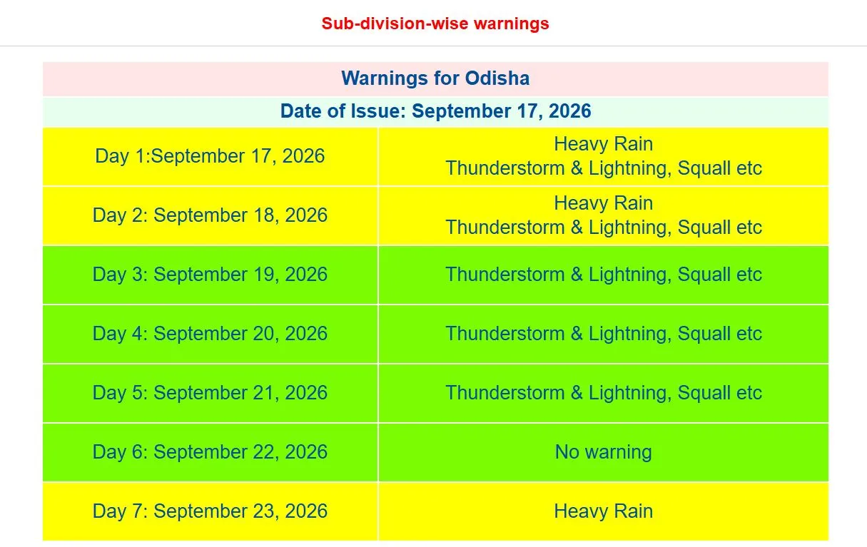
Low-pressure Area To Bring Heavy Rains
By evening of September 18, a cyclonic circulation that has developed over northern Thailand, will shift towards the North Andaman Sea. As a result, a low pressure area will develop around September 19. Over the next few days, this system will bring in intense showers to the state as it moves west-northwestwards towards the coasts of southern Odisha and northern Andhra Pradesh.
"People should not panic. The IMD has not predicted any cyclone at this stage. A low-pressure system is forming, which will bring heavy rainfall to Odisha, but there is no threat of a cyclone to the state right now," IMD Director General Dr Mrutyunjay Mohapatra said, as quoted by dishabytes.com.
“There is a likelihood of the development/emergence of an upper air cyclonic circulation over the North Andaman Sea and adjoining Thailand in the first half of week 2 (around September 20),” IMD stated in its bulletin.
The weather body added that the system will shift northwestwards as a cyclonic circulation or low pressure area. It shall then reach south Odisha and north Andhra Pradesh coast around September 22.