- By Vivek Raj
- Thu, 05 Oct 2023 02:51 PM (IST)
- Source:JND
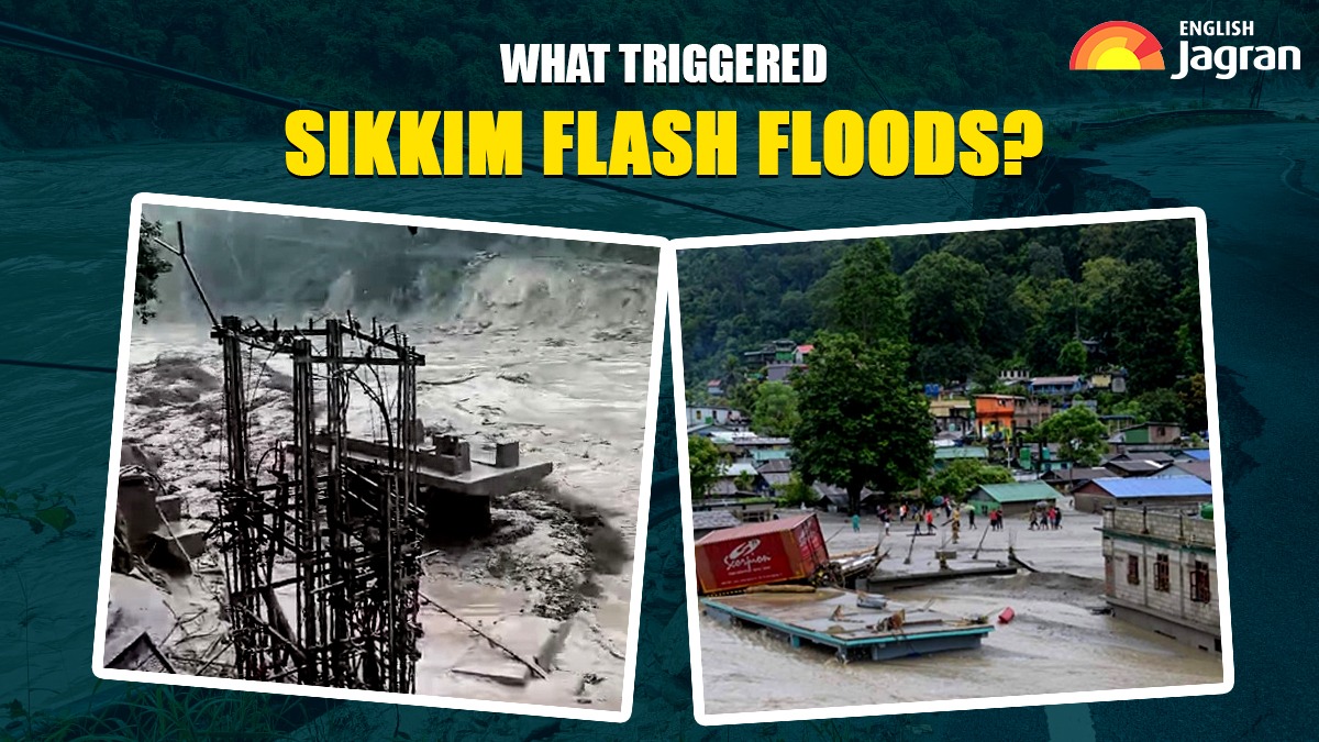
Flash floods struck Sikkim on October 4 resulting in 14 deaths while 102 people are still missing including 22 Army personnel. 26 people have suffered injuries due to the flash floods in the state. The disaster washed away 11 bridges, affecting a population of over 22,000 people. According to Sikkim State Disaster Management Authority (SSDMA), the trigger was the bursting of South Lhonak Lake due to incessant rains, causing the Teesta River to flood four districts including Mangan, Gangtok, Pakyong and Namchi. Search and rescue operations led by the Army and NDRF are underway, with the Indian Air Force on standby. More than 3,000 tourists are stranded and damaged infrastructure raises concerns about food supplies. The Army is assembling Bailey bridges to restore connectivity.
What happened in Sikkim's South Lhonak Lake and what triggered flash floods?
Sikkim on Wednesday witnessed devastating flash floods, claiming lives and causing widespread destruction. The primary trigger for this disaster was identified by the National Disaster Management Authority as a combination of excessive rainfall and a Glacial Lake Outburst Flood (GLOF) event at South Lhonak Lake in North Sikkim. The exact cause is still under investigation.
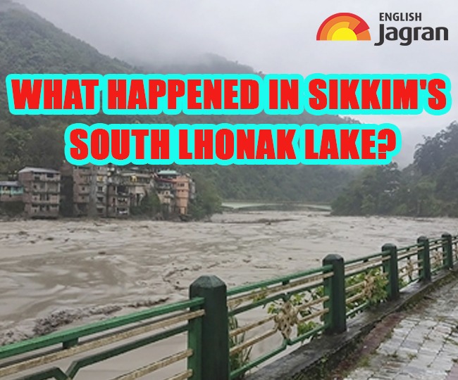
Reports indicate that a cloudburst over Lhonak Lake, located approximately 150 km north of Gangtok near the Chinese border, initiated the torrential flooding. This lake outburst event also led to the breach of the Chungthang Dam, which is the state's largest hydropower project.
The vulnerability of Lhonak Lake to GLOFs had been previously highlighted in a 2013 report by scientists from the National Remote Sensing Centre in Hyderabad. “The lake outburst probability shows a very high value of 42 per cent for the lake and peak discharge estimated using the empirical formula shows a discharge of 586 m3/s,” the report said.
In a report titled, “Sikkim at risk of devastating floods from glacial lake outbursts”, Down to Earth said, “Surrounded by potentially dangerous glacial lakes that can burst and cause floods any time, Sikkim is a ticking time bomb.”
ALSO READ: Why NewsClick Is Under Radar Over China Links | Controversy Explained
Scientists from the National Remote Sensing Centre had previously warned of the dangers associated with Lhonak Lake a decade ago. The 2013 study indicated a high probability of a lake outburst, with estimated peak discharge reaching 586 m³/s.
In 2019, another report from the Sikkim State Disaster Management Authority reiterated the lake's vulnerability to GLOF events, emphasising the potential for flash floods and damage to critical infrastructure downstream.
Did Nepal Earthquake Cause Sikkim Flash Floods?
The possibility of the Nepal earthquake being linked to the flash floods in Sikkim is currently under investigation. On Tuesday, Nepal experienced a series of earthquakes within one hour, causing significant tremors across northern India.
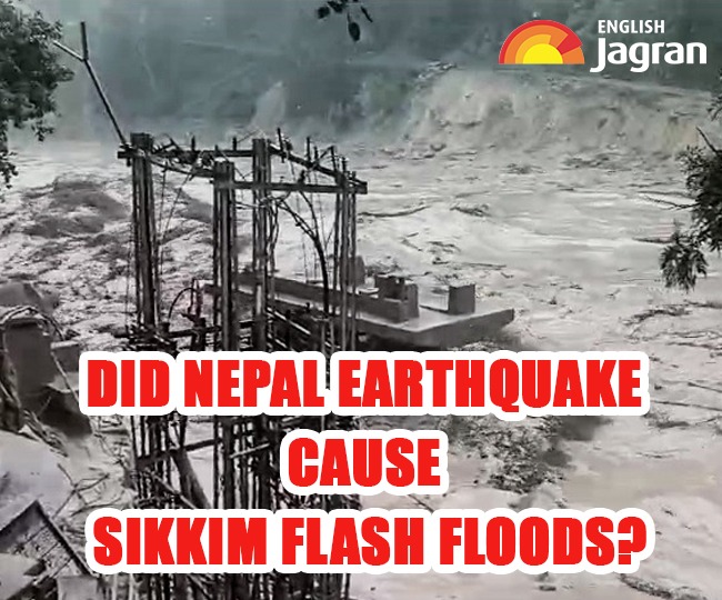
A day later, the South Lhonak Lake outburst in Sikkim resulted in flash floods in the Teesta River basin, causing loss of life. Scientists are now examining whether the earthquake from the previous day played a role in this disaster.
It's worth noting that Glacial Lake Outburst Floods (GLOFs) can also be triggered by seismic activity. While initial assessments suggest heavy rainfall from a Bay of Bengal low-pressure system as a contributing factor, experts have not ruled out the possibility of earthquake-related triggers. Some specialists who have visited the affected area believe that the earthquake could have played a role in initiating the floods.
The vulnerability of the South Lhonak Lake, which had already covered an extensive area of 168 hectares, is evident from the substantial reduction to 60 hectares. This indicates that around 100 hectares of water volume breached the lake's containment, news agency PTI quoted citing the officials at the Central Water Commission (CWC). The official also stated that while it’s difficult to determine the exact cause, this type of outcome is not typically caused by cloud bursts.
Down to Earth in its report also has said previously, “Due to increase in the rate of melting of the glaciers, lakes are increasing in the area and so is their stored water capacity. Sikkim falls in Zone-IV of the Indian seismic chart and earthquakes may trigger GLOF.”
What is A Glacial Lake Outburst Flood (GLOF)?
A Glacial Lake Outburst Flood (GLOF) is a catastrophic event characterised by the sudden release of a large volume of water from a glacial lake, often caused by the failure of the natural dam that holds the lake in place. GLOFs typically occur due to various factors:
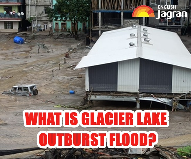
Melting Glaciers: Rapid glacier melting, a consequence of climate change, can lead to an increase in water volume within the glacial lake.
Heavy Precipitation: Intense rainfall or heavy snowmelt can contribute to the buildup of water in the lake.
Inflow of Meltwater: The inflow of meltwater from the glacier into the lake can elevate water levels.
Earthquakes: Seismic activity, such as earthquakes, can trigger GLOFs by disrupting the stability of the natural dam or directly releasing water from the glacier.
The Hindu Kush Himalayas are particularly susceptible to GLOFs due to the retreat of glaciers caused by climate change. This retreat has given rise to the formation of numerous new glacial lakes, which can become potential sources of GLOFs.
ALSO READ: How Election Commission Is Prepping Up For Upcoming Polls In Five States
As the glacial lake's volume grows, it exerts increasing pressure on the natural dam. Factors like glacier fragmentation, landslides, or even water seepage can disrupt the dam's stability, potentially resulting in a catastrophic GLOF event.
Rerun of 55-year-old havoc
History repeated itself in Sikkim, exactly 55 years later, as the Darjeeling-Sikkim region relived a devastating calamity.
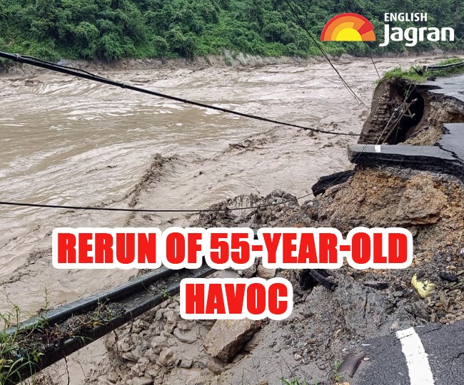
Back in 1968, the region witnessed four days of relentless rainfall from October 2 to 5, triggering numerous landslides, destroying homes and bridges, and claiming the lives of approximately 1,000 people.
One iconic landmark, the Anderson Bridge at Teesta Bazar, had been completely washed away on October 4, 1968. Astonishingly, five and a half decades later, on a fateful Wednesday, the Teesta River once again overflowed at the very location where the Anderson Bridge had once stood, underscoring the cyclical nature of the region's vulnerabilities to natural disasters.