- By Priyanka Koul
- Wed, 05 Mar 2025 07:29 AM (IST)
- Source:JND
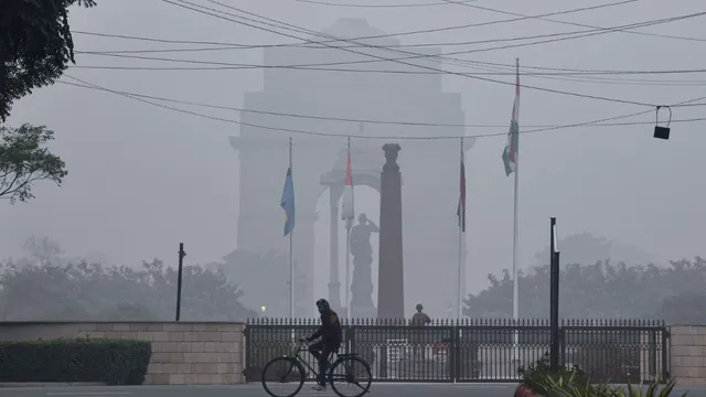
Weather Update: For the past week, heavy snowfall and rain have been affecting the hill states of India. On Tuesday, the impact of these weather conditions was also felt in Delhi-NCR, where chilly winds and cloud cover led to a significant drop in temperature by evening. The cold wave is expected to persist, making winter-like conditions return in many areas.
Fresh snowfall and rain in Jammu & Kashmir, Himachal Pradesh, and Uttarakhand disrupted daily life on Tuesday. Some areas even experienced hailstorms, making conditions harsher for residents. The Indian Meteorological Department (IMD) predicts dry weather on Wednesday, but from 10th to 12th March, another round of snowfall and rain is expected in Kashmir due to western disturbances. Hailstorms were also reported in Shimla and Kangra.
Cold Winds Affecting Uttar Pradesh and Bihar
The impact of snowfall in the northern hills is being felt in Uttar Pradesh, where cold winds are sweeping through several regions. In Bihar, many districts experienced partly cloudy skies on Tuesday, bringing a slight drop in temperatures.
Jammu-Srinagar Highway Reopened After Landslides
In Kashmir, fresh snowfall and rain kept temperatures below normal, increasing the chill. While Jammu enjoyed a sunny day, the Jammu-Srinagar Highway, which was blocked on Monday evening due to landslides in Ramban, was reopened by 10 AM on Tuesday.
IMD forecasts indicate dry weather for Wednesday, but another spell of snowfall and rain is expected in Kashmir from 10th to 12th March. On Monday, heavy snowfall was recorded in higher regions like Gulmarg, while lower areas, including Srinagar, witnessed continuous rainfall.
Heavy Snowfall and Hailstorms in Himachal
For the past six days, Lahaul-Spiti and Manali have been experiencing continuous snowfall. On Tuesday, nearly a foot of fresh snow was recorded in Rohtang and nearby peaks. Kinnaur’s high-altitude regions also received snowfall, while hailstorms hit parts of Shimla and Kangra. Rohtang Pass, Baralacha, Shinkula, and Kunzum Pass have received over six feet of snow in the past week, making travel conditions challenging.
Western Disturbance to Bring More Snow from 9th March
The Border Roads Organisation (BRO) managed to restore one-way traffic on the Manali-Sissu road in Lahaul after six days of disruption. According to IMD, weather conditions will remain clear until 8th March, but from 9th March, another western disturbance will bring fresh snowfall and rain.
In Kangra district’s Dadaseba tehsil, lightning struck four houses on Tuesday afternoon, injuring two people, including a young woman. The incident caused property damage worth several lakhs.
Snowfall in Char Dham and Other High Himalayan Areas
Uttarakhand saw fresh snowfall on Tuesday in Badrinath, Kedarnath, Gangotri, Yamunotri, Hemkund Sahib, Harsil, and Munsiyari in Pithoragarh. Due to heavy snow, the Gangotri highway beyond Sukki Top in Uttarkashi was blocked. In Pithoragarh, the Tawaghat-Lipulekh highway, which connects to the China border, remained shut for the fourth consecutive day due to snowfall.
Lower altitude regions received rain, adding to the winter chill. However, meteorologists predict that from Wednesday onwards, clear skies and sunshine will bring a gradual rise in temperatures.