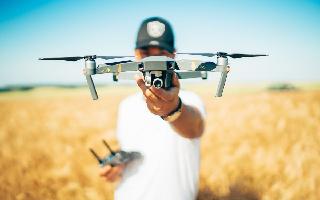
Technology has changed the landscape in many industries, including agriculture. Everything, from drones to the introduction of new mapping technology, is assisting farmers at every stage of agriculture. In an exclusive interview with Jagran English, BharatRohan's CEO and Co-Founder shed some insight on how technology is assisting farmers.
1. How has the integration of UAV technology and hyperspectral imagery transformed the agricultural landscape in India? What's the situation now?
● Precision Monitoring: UAVs are equipped with hyperspectral cameras capable of capturing images in various wavelengths of light, including those beyond human perception. These cameras can capture detailed information about crop health, moisture levels, and even subtle variations in plant colour. By flying UAVs over their fields regularly, farmers can obtain precise and high-resolution images of their crops, which was previously impossible with traditional methods.
● Early Pest and Disease Detection: One of the most significant advantages is the early detection of pest infestations and diseases. Hyperspectral imagery can detect subtle colour changes in plants, often before visible symptoms appear. Farmers can identify problem areas in their fields based on these images, allowing them to take proactive measures to address issues. For example, if a particular section of a field shows signs of stress in hyperspectral images, the farmer can investigate further and apply treatments if necessary, reducing crop losses.
● Early Pest and Disease Detection: One of the most significant advantages is the early detection of pest infestations and diseases. Hyperspectral imagery can detect subtle color changes in plants, often before visible symptoms appear. Farmers can identify problem areas in their fields based on these images, allowing them to take proactive measures to address issues.
● Reduced Chemical Usage: With hyperspectral data, farmers can use pesticides and herbicides more judiciously. By identifying specific areas affected by pests or weeds, they can apply chemicals only where needed.This reduces the overall use of chemicals in agriculture, leading to fewer negative environmental effects and lower costs for farmers.
● Data-Driven Decision-Making: The data collected from UAVs and hyperspectral imagery is processed and presented to farmers in a user-friendly formatFarmers can access this information through mobile apps or web platforms, making it easy for them to make data-driven decisions about crop management.
● Sustainable and Profitable Farming: Overall, the integration of UAVs and hyperspectral imagery promotes sustainable and profitable farming practices. It reduces the environmental impact of agriculture by optimising resource use, minimising chemical applications, and conserving water. Simultaneously, it enhances profitability by increasing crop yields and reducing losses due to pests and diseases.
2. Can you share specific examples of the impact this technology has had on farmers and the agricultural value chain?
● Early Detection of Crop Issues: Hyperspectral imaging can detect subtle colour changes in plants, allowing for early warnings of pest infestations or diseases. For example, farmers can identify pest infestations before they become visible to the naked eye and take proactive measures.
● Optimised Resource Management: UAV technology and hyperspectral imagery help farmers optimise irrigation and fertilisation. By analysing crop health and moisture levels, farmers can precisely tailor their resource usage, reducing costs and environmental impact.
● Improved Pest Control: Farmers can target pesticide application more accurately based on hyperspectral data, reducing the overuse of chemicals and minimising environmental harm.
3. In what ways are drones utilised in precision agriculture, particularly in the collection of hyperspectral imagery?
● Drones have become indispensable tools in modern agriculture due to their versatility and efficiency. These unmanned aerial vehicles (UAVs) offer numerous benefits to farmers and agribusinesses. They can swiftly cover vast areas of farmland, providing timely and high-resolution data. Drones are particularly useful for crop monitoring, allowing farmers to assess the health of their crops, detect pest infestations and diseases, and make informed decisions about agri-inputs. They also aid in precision agriculture by enabling precise and targeted application of fertilisers, pesticides, and other treatments, reducing waste and environmental impact. Moreover, drones play a vital role in yield prediction, helping farmers estimate their crop yields more accurately.
● Drones equipped with hyperspectral imagery technology provide a significant competitive advantage in crop monitoring. Unlike traditional visual cameras, hyperspectral cameras on drones can capture a wide range of wavelengths, including those beyond the human eye's capability. This capability allows for a detailed analysis of plant health, as hyperspectral images reveal subtle colour changes that indicate stress or early signs of pest infestations and diseases.
As a result, hyperspectral-equipped drones enable farmers to detect issues at their earliest stages, facilitating proactive measures and reducing crop losses. The precision and scientific accuracy of hyperspectral data make it an invaluable tool for optimising agricultural practices and ensuring higher crop yields, setting them apart in the realm of precision agriculture.
4. How does this technology contribute to real-time monitoring of crop health, moisture levels, and pest infestations, and what benefits does it bring to farmers?
Hyperspectral imaging technology on drones contributes to real-time monitoring of crop health, moisture levels, and pest infestations by capturing detailed and precise data. This technology allows farmers to:
● Crop Health Monitoring: Hyperspectral imagery detects subtle colour changes in plants, indicating their health status. Farmers can monitor crops in real-time, identifying stress factors like nutrient deficiencies or diseases early.
● Moisture Level Assessment: Hyperspectral data reveals variations in soil moisture content, helping farmers manage irrigation more efficiently and avoid overwatering or under-watering, which can impact crop health.
● Pest Infestation Detection: Hyperspectral imaging can spot pest infestations before they
become visible to the naked eye. This early detection enables timely pest control measures, reducing crop damage.
Benefits to farmers include increased crop yields, reduced input costs, minimised losses, and sustainable agricultural practices. By acting on real-time data, farmers can optimise resource usage and enhance overall farm profitability.
5. How does your company empower farmers with data-driven insights, and what role does this play in their decision-making processes?
BharatRohan empowers farmers with data-driven insights through its advanced UAV-based decision support system and Hyperspectral Imaging technology. Our role in their decision making processes is pivotal:
● Data Collection: We utilise drones equipped with Hyperspectral Imaging cameras to capture detailed data about crop health, soil conditions, and pest infestations across farmers' fields.
● Real-Time Monitoring: Farmers receive real-time updates and insights about their crops, allowing them to monitor conditions and detect issues early.
● Data Analysis: Our team analyses the collected data to provide actionable insights. We identify areas requiring attention, recommend specific agri-inputs, and suggest pest control strategies.
● Customised Recommendations: Farmers receive tailored recommendations based on their field data, enabling them to make informed decisions about fertilisers, irrigation, and pest management.
● Enhanced Decision-Making: With precise, data-driven insights, farmers can optimise resource allocation, reduce input costs, and maximise yields. This leads to more sustainable and profitable farming practices.
6. Can you provide examples of how farmers have utilised the information obtained from UAV technology to enhance their choices regarding irrigation, fertilisation, and pest control?
● Optimising Irrigation: Farmers in a region with varying soil moisture levels used UAV data to create moisture maps of their fields. By analysing these maps, they identified areas that required more or less irrigation. As a result, they reduced water wastage, improved crop health, and saved on irrigation costs.
● Precision Fertilisation: In another case, a farmer received nutrient deficiency alerts from UAV data analysis. Using this information, they applied specific fertilisers only where needed, rather than blanket fertilisation. This precision approach not only saved on fertiliser expenses but also enhanced crop nutrient uptake and yield.
● Timely Pest Control: A group of farmers received early pest infestation warnings through UAV imagery. They promptly targeted affected areas with precise pesticide applications, preventing the spread of pests and minimising crop damage. This proactive approach reduced the need for extensive pest control measures and increased overall crop quality.
7. How does big data analytics play a role in helping farmers and corporate partners optimise their investments and maximise returns?
Big data analytics plays a crucial role in helping farmers and corporate partners optimise their investments and maximise returns in several ways:
● Data-Driven Insights: Big data analytics processes vast amounts of agricultural data, including weather patterns, soil conditions, crop health, and market trends. This information provides farmers and corporate partners with valuable insights into the factors affecting their operations.
● Predictive Modelling: By analysing historical and real-time data, big data analytics can
create predictive models for various agricultural variables. These models help farmers make informed decisions about planting times, crop selection, and resource allocation. ● Resource Efficiency: Analytics identifies opportunities to optimise resource usage, such as water, fertilisers, and pesticides. Farmers can adjust their practices to reduce waste and increase efficiency, ultimately reducing input costs.
● Risk Management: Big data analytics assesses risks associated with crop diseases, pest infestations, and adverse weather events. This enables farmers to implement risk mitigation strategies and protect their investments.
● Market Intelligence: Farmers and corporate partners can access market data and pricing trends through analytics. This information helps them make informed decisions about when and where to sell their products, maximising returns.
● Supply Chain Optimization: Corporate partners benefit from analytics by optimising supply chain logistics. This includes efficient transportation, inventory management, and demand forecasting, leading to cost savings and improved profitability.
● Sustainability: Analytics assists in implementing sustainable farming practices. By monitoring environmental impacts and resource usage, farmers and corporate partners can meet sustainability goals and appeal to environmentally conscious consumers.
8. What do you see as the future possibilities and developments in the intersection of agriculture, UAV technology, and hyperspectral imagery?
● Multi-Sensor Integration: Combining hyperspectral imaging with other sensors, such as LiDAR or thermal imaging, could provide a more comprehensive view of crop and soil conditions. This integrated data could lead to even more precise decision-making.
● Global Agricultural Impact: The adoption of this technology could extend beyond individual farms to have a global agricultural impact. It could contribute to sustainable farming practices, reduce food waste, and enhance food security worldwide.
● Environmental Monitoring: Hyperspectral-equipped UAVs could be used for broader environmental monitoring, including assessing the health of forests, wetlands, and natural
ecosystems. This has implications for biodiversity conservation and climate change mitigation.
● Flood Mapping: Combining hyperspectral imagery with other geospatial data, such as topography and hydrological models, can lead to the creation of detailed flood risk and flood extent maps. These maps can serve as valuable tools for both insurers and government agencies in planning and response efforts.