
- By Aditi Priya Singh
- Thu, 17 Jul 2025 02:46 PM (IST)
- Source:JND
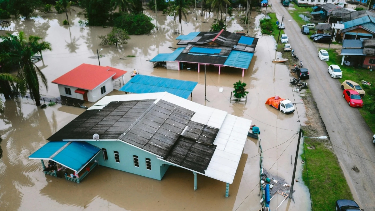
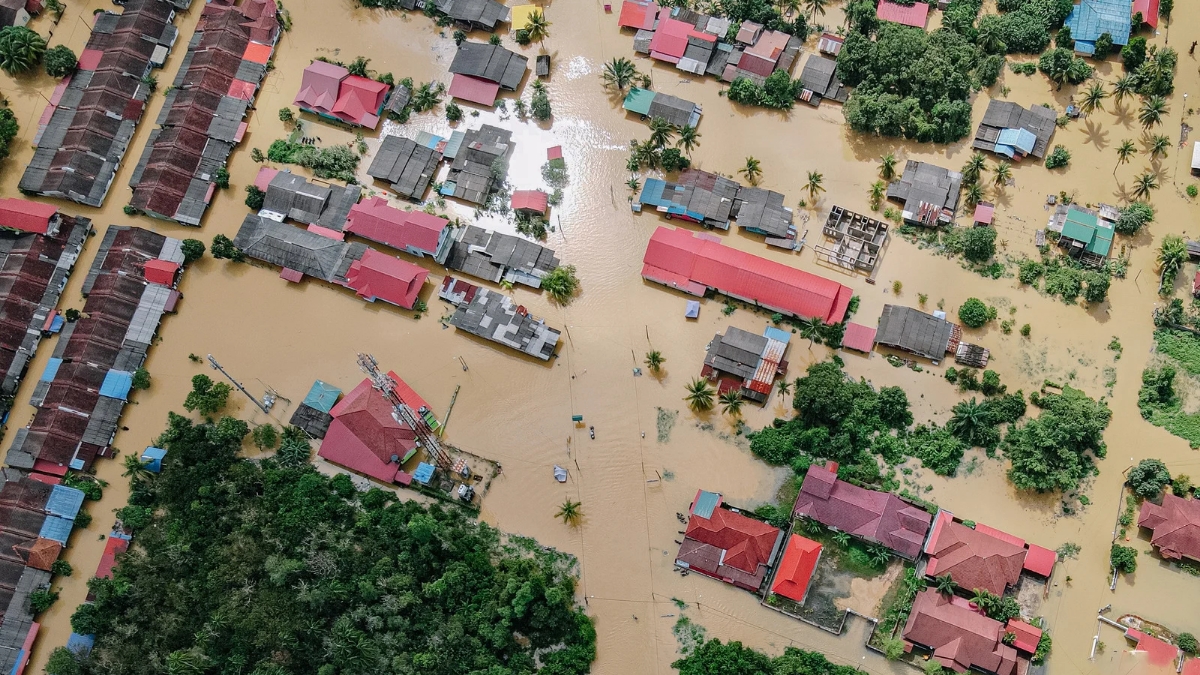
Top 10 Flood-Affected States In India: Floods are one of the most common and damaging natural disasters in India. Every year, during the monsoon season, rivers overflow from heavy rainfall, causing damage to highways, homes and crops in several states. Some states are more affected than others because of their location, geography, and rainfall patterns. Bihar, Assam, Uttar Pradesh and some others are among the states most affected by flooding, which occurs almost yearly. In these areas, during the rainy season, major rivers like the Ganga, Brahmaputra, and their tributaries overflow into towns and villages.
Millions of hectares of land are under water, forcing people to leave their homes. Floods damage property and crops, but they also affect the safety and well-being of locals. The problem is made worse by deforestation, inadequate drainage and a lack of planning. At present, Varanasi is facing a flood-like situation as the river Ganga swells across Uttar Pradesh. Ganga's water level crossed the danger marks at the many important city ghats.
Top 10 Flood-Affected States In India
In this article, we have listed the top 10 flood-affected states in India, how many districts are affected, and the reasons behind the high frequency of floods in these states as per the government report.
| Rank | States | Number of Affected Districts | Affected area in hectares |
| 1. | Bihar | 38 | 3976861 |
| 2. | Assam | 35 | 2464958 |
| 3. | Uttar Pradesh | 72 | 2662942 |
| 4. | West Bengal | 20 | 1969750 |
| 5. | Andhra Pradesh | 24 | 738200 |
| 6. | Tamilnadu | 24 | 552010 |
| 7. | Gujarat | 16 | 517770 |
| 8. | Karnataka | 26 | 280156 |
| 9. | Maharashtra | 20 | 233590 |
| 10. | Madhya Pradesh | 30 | 210809 |
Source: nrsc.gov.in pdf report (1998 to 2022 report)
1. Bihar
 Top 10 flood-affected States in India (Image: Canva)
With all 38 districts affected and more than 39.76 lakh hectares of land suffering from flood damage, Bihar is the most flood-prone state in India. The primary cause is the overflow of rivers that flow into the plains from the Himalayas, such as the Ganga, Kosi, and Gandak, which bring with them water and silt. The situation is exacerbated during the monsoon season by weak embankments and inadequate drainage.
2. Assam
Assam's location in the Brahmaputra River valley makes it vulnerable to severe flooding. About 24.65 lakh hectares are spread across 35 districts that are impacted. Widespread flooding is caused by the Brahmaputra and its tributaries swelling during periods of intense rainfall. Assam is made even more vulnerable by deforestation, erosion, and inadequate urban planning.
3. Uttar Pradesh
-1752743656270.jpg) Flood-affected states in India (Image: Canva)
Flood-affected states in India (Image: Canva)
In Uttar Pradesh, 26.63 lakh hectares are affected by floods in 72 districts. During the monsoon season, the state's major rivers, including the Ganga, Yamuna, and Ghagra, overflow. Recurrent floods are also caused by low-lying terrain and abundant rainfall in nearby states.
ALSO READ: List Of Top 10 Healthiest States In India By 2025: Odisha Leads The List
4. West Bengal
West Bengal experiences floods in 20 districts, impacting 19.69 lakh hectares of land. The Ganga and its tributaries, along with coastal rains and cyclones, are the main causes. Siltation of rivers and unplanned development in floodplains worsen the damage.
5. Andhra Pradesh
 Top 10 flood-affected States in India (Image: Canva)
Andhra Pradesh's floods impact 7.38 lakh hectares across 24 districts. Rivers like Godavari and Krishna can overflow, putting the state at risk, particularly during cyclones and intense monsoons. Backwater flooding and storm surges are common in coastal regions.
6. Tamil Nadu
Floods affect 5.52 lakh hectares in 24 districts of Tamil Nadu. Because of inadequate drainage and encroachment on water bodies, urban flooding is a common occurrence in cities such as Chennai. Sudden floods are also brought on by cyclonic rains and dams releasing excess water.
7. Gujarat
Flooding in 16 districts of Gujarat damages 5.17 lakh hectares. Flash floods are caused by abrupt dam releases and heavy monsoon rainfall. Cities with inadequate stormwater drainage are also more vulnerable to flooding.
8. Karnataka
There are roughly 2.80 lakh hectares of flood-affected land spread across 26 districts in Karnataka. Rivers like the Krishna and Tungabhadra overflow as a result of the heavy monsoon rains that fall on the Western Ghats. Floods are also caused by soil erosion and deforestation.
ALSO READ: Top 10 Hottest Countries In The World Where Temperature Hits Extreme Levels
9. Maharashtra
 Top 10 flood-affected States in India (Image: Canva)
Floods affect 2.33 lakh hectares in 20 districts of Maharashtra. During the monsoon, rivers like the Godavari and Krishna overflow, and cities like Mumbai experience waterlogging as a result of heavy rainfall and inadequate drainage systems.
10. Madhya Pradesh
In Madhya Pradesh, 30 districts and about 2.10 lakh hectares are affected by flooding. Although the state is in the central highlands, nearby areas are frequently flooded by rivers like the Narmada and Betwa due to low-lying river basins and intense monsoon rainfall.