- By Supratik Das
- Sat, 12 Jul 2025 12:56 PM (IST)
- Source:JND
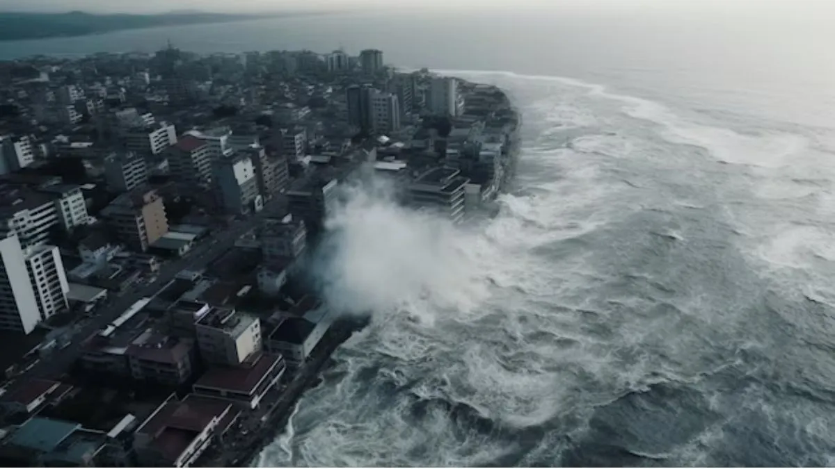
Cascadia threat: While the world continues to keep an eye on AI threats and increasing global tensions, a latest scientific alert has again brought into focus an underappreciated but gargantuan natural disaster threat hovering over North America. A recent study, released in the Proceedings of the National Academy of Sciences (PNAS), has stirred new concern regarding the Cascadia Subduction Zone, a 1,000-km-long fault that runs from northern California to British Columbia.
'Sleeping Giant' Fault May Cause Earthquake, 100-Foot Tsunami
The Cascadia Subduction Zone has been relatively quiet for more than 300 years. Scientists, explain that when it does finally break, it will release one of the largest earthquakes on record in the US. The megaquake will potentially be followed by a destructive tsunami with waves up to 100 feet high that will impact coastal towns in California, Oregon, Washington, and British Columbia in Canada. The study, conducted by Prof Tina Dura and titled 'Increased flood exposure in the Pacific Northwest following earthquake-driven subsidence and sea-level rise,' finds that when a big quake strikes, large tracts of land may sink by 0.5 to 2 meters within just minutes. Prof Dura said to BBC Science Focus, "We hear a lot about climate-induced sea level rise of three to four millimetres per year, but here we are discussing up to two metres in minutes. Why aren't we discussing that more?"
The combination of sudden ground subsidence and continuously rising sea level would hugely raise the hazard of coastal flooding. By 2100, the study puts the estimated number of people, residences, structures, and critical roads that will be flooded in the Pacific Northwest at more than triple, if nothing is done. Although slow sea-level rise is the focus of climate change controversy, the threat of sudden earthquake-induced subsidence needs much more public and policy focus.
Uneven Land Movements Make it More Difficult
The research observes that not all coastal locations are impacted equally. Some cities, such as Astoria (Oregon) and Crescent City (California), are actually experiencing land uplift as a result of tectonic movements beneath the ground, temporarily counterbalancing rising sea levels. Yet other locations, such as Yaquina Bay and Coos Bay, are increasing much more slowly, resulting in continuous sea-level rise. One key hotspot is Humboldt Bay in Northern California, where the land is already sinking. By 2030, local sea levels are projected to outpace the land’s ability to rise, adding significant flood risk. By 2050, water levels could rise by 10 to 30 cm, and by 2100, by up to 90 cm if carbon emissions continue unchecked.
This research highlights the need for immediate disaster preparedness, enhanced building codes, and enhanced coastal protection measures. "This is going to be a very disastrous event for the US, period," Prof Dura emphasized, noting that although some measures might save some coastal communities from the worst effects of the tsunami because of natural barriers, there are still a lot of areas exposed to instant loss of land and permanent flooding.".