- By Ridam Sharma
- Sat, 26 Jul 2025 07:05 PM (IST)
- Source:JND
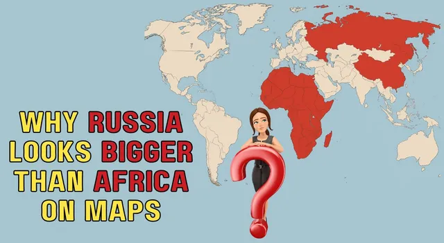
Russia Africa size: Russia seems bigger than Africa on many maps, mainly because of how the Mercator projection works. Do you know what the Mercator projection is? It is a way to turn the round Earth into a flat map. In simpler words, it turns a 3D map into a flat 2D map. Imagine wrapping a cylinder around a globe and shining a light from inside; the countries cast shadows on the cylinder, which we then unroll into a flat map. This kind of map keeps shapes and directions correct, which is very useful for sailors and navigation.
Therefore, the Mercator map distorts areas close to the poles, like Russia, which makes the country look significantly larger than it actually is. Additionally, it is important to know that as the areas move away from the equator and towards the poles, the map becomes increasingly stretched out. Africa is situated close to the equator, which makes it appear smaller on the map despite being nearly double the size of Russia in real size.
Also Read: Did You Know You Need 24 Crore In Your Pocket To Access This Country's Airport Lounge
For example, Greenland looks enormous on the rectangular maps, as big as Africa, but do you know, in actual Greenland is about 14 times smaller than Africa? This is due to size distortion, which is caused by the enlargement of the areas that are farther away from the equator in the Mercator projection map.
So, when you look at Russia appearing bigger than Africa on a world map, it's not that Russia is larger, but because of the map’s stretching effect. When you use a globe or various map types, you will be able to compare the size of different places in reality, especially Africa’s which is significantly bigger than that of Russia.
Also Read: Ever Wondered Why Sea Water Is Salty But River Water Isn’t?
In other words, the Mercator projection is perfect for knowing the direction or location of different nations, but not for knowing the actual size of landmasses, particularly close to the poles. This makes large nations far from the equator appear considerably larger than they are. This is the prime reason why Russia appears larger than Africa on most maps, yet in reality, Africa is the larger in landmass. Globes or other types of maps provide a more accurate, more realistic picture of how large countries and continents are from each other.