- By Sahelee Rakshit
- Fri, 24 May 2024 08:58 PM (IST)
- Source:JND
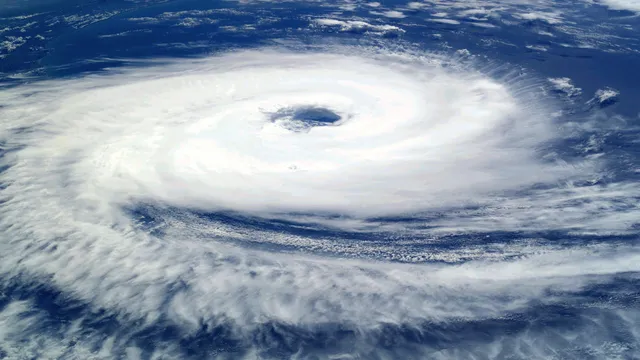
Cyclone Remal Updates: The National Crisis Management Committee (NCMC), chaired by Cabinet Secretary Rajiv Gauba, met on Friday to evaluate preparations for the coming storm 'Remal' in the Bay of Bengal, according to an official announcement. The Committee was informed by the Director General of the India Meteorological Department (IMD) about the current state of the depression over the central Bay of Bengal, which is about 810 km south of Canning (West Bengal) and around 800 km south-southwest of Khepupara (Bangladesh).
As per the release, "The cyclone is very likely to move northeastwards and intensify further into a severe cyclonic storm by the night of May 25. Thereafter, it will move nearly northwards and very likely to cross Bangladesh and adjoining West Bengal coasts between Sagar Island and Khepupara around May 26 midnight as a severe cyclonic storm with wind speed of 110-120 kmph gusting to 130 kmph from the evening of May 26."
Cyclone Remal: Key Points
- Cyclone Remal is likely to make landfall between the Bangladesh and West Bengal coasts around midnight on May 26. IMD scientist Dr Somenath Dutta said Cyclone Remal may make landfall between Sagar Island in West Bengal and Khepupara in Bangladesh. In Bengal, significant damage to thatched huts, tree uprooting, and power outages are anticipated.
- Areas including Dakshin (South), 24 Pargana, Purba Medinipur, Howrah, Hoogli, Kolkata and Nadia may be impacted. However, coastal regions will see the initial effects, according to IMD. On May 26, West Bengal's coastal areas may see extremely heavy rains. Heavy rains may persist on May 27 and 28.
- In preparedness for the upcoming cyclone 'Remal', individuals who are at sea have been urged to return to safe berths and fishermen have been instructed not to go out into the sea. The situation is being monitored by District Control Rooms, which have also been activated. Preparations have been made for emergency services, electricity supply, medication, and enough shelters.
- The 12 teams that have been sent by the National Disaster Response Force (NDRF) are accompanied by 5 standby teams. The region's sea surface temperatures (SSTs) are now over 30 degrees Celsius, with some locations in the central and northern Bay of Bengal reaching 32 degrees Celsius or higher. Warm temperatures create the ideal conditions for cyclone development by delivering heat and moisture, according to IMD.
- The IMD has predicted that the cyclone could reach a wind speed of 102 kilometres per hour on Sunday, 26 May. Furthermore, light to moderate rainfall with isolated heavy downpours may affect Odisha's Balasore district from May 25-27, West Bengal's North and South 24 Parganas and East Medinipur, Mizoram, Tripura, and South Manipur on May 25-26, and Assam, Meghalaya, and Arunachal Pradesh on May 26.

