- By Aditi Priya Singh
- Thu, 07 Aug 2025 06:36 PM (IST)
- Source:JND
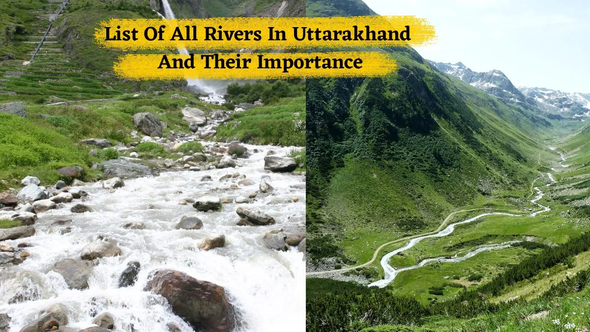
List of Rivers in Uttarakhand and Their Importance: Uttarakhand, known as the "Land of the Gods", has many powerful and sacred rivers flowing through the valleys and hills. Most of these rivers begin in the glaciers of the Himalayas. They are not just bodies of water but they are deeply connected to the culture, religion and economy of Uttarakhand. Rivers like the Ganga, Yamuna, Alaknanda, Bhagirathi, and Mandakini hold great spiritual importance for millions across India.
These rivers are crucial for daily life as well as for their religious roles. They generate hydroelectric power that provides electricity for homes, support farmers by supplying irrigation for crops, and offer clean drinking water. Local industries, wildlife, and groundwater recharge also rely on rivers like the Gaula, Kosi, and Ramganga. These rivers make travel and tourism easier and help maintain the state's natural beauty since Uttarakhand is a hilly region.
List of Rivers in Uttarakhand and Their origin, area and Importance
However, it is essential to protect these rivers from misuse and pollution. By understanding each river's history, coverage and importance, we can better appreciate how nature supports life in the mountains. Here is the list of all popular and unpopular rivers that flow in Uttarakhand and their importance to the lives of people there.
| River Name | Origin | Area in state (approx KM) | Area Covered (Districts/Regions) |
|---|---|---|---|
| Ganga | Gangotri Glacier | 320 Km | Haridwar, Rishikesh, Tehri, Devprayag |
| Yamuna | Yamunotri Glacier | 170 Km | Dehradun, Uttarkashi |
| Alaknanda | Satopanth Glacier | 190 Km | Chamoli, Rudraprayag, Pauri Garhwal |
| Bhagirathi | Gangotri Glacier | 205 km | Tehri, Uttarkashi |
| Tons | Bandarpunch Range | 170 km | Uttarkashi, Dehradun |
| Kali (Sharda) | Kalapani, Pithoragarh | 252 km | Pithoragarh, Champawat |
| Ramganga | Doodhatoli Hills | 157.57 km | Nainital, Bijnor |
| Mandakini | Chorabari Glacier | 72 km | Rudraprayag |
| Pindar | Pindari Glacier | 105 km | Chamoli |
| Saryu | Milam Glacier | 130 km | Bageshwar, Almora |
| Gaula | Sattal | 103 km | Haldwani, Nainital |
| Kosi | Someshwar, Almora | 168 km | Almora, Nainital, Ramnagar |
Importance of These Rivers To The People of the State
1. Ganga
* Considered the most sacred river in India.
* Primary source of drinking water for millions.
* Used for religious rituals and pilgrimage (e.g., Haridwar, Rishikesh).
* Supports large-scale irrigation for agriculture.
* Boosts tourism and spiritual economy.
2. Yamuna
* Major tributary of the Ganga.
* Supplies water for irrigation and domestic use in western Uttarakhand.
* Holds high religious and cultural importance (Yamunotri Dham).
* Supports horticulture and agriculture in its basin.
3. Alaknanda
* Merges with Bhagirathi to form the Ganga at Devprayag.
* Crucial for hydroelectric projects like Vishnuprayag and Srinagar.
* Provides irrigation water to hill farms.
* Important pilgrimage route (Char Dham path).
4. Bhagirathi
* Origin of the Ganga before merging with the Alaknanda.
* Site of many religious and cultural activities.
* Key river for hydropower generation (Tehri Dam).
* Supplies water for both rural and urban use.
5. Tons
* Largest tributary of the Yamuna.
* Supports agriculture and farming in Uttarkashi and Dehradun.
* Used in hydroelectricity production.
* Helps maintain ecological flow in western Uttarakhand.
6. Kali (Sharda)
* Natural boundary between India and Nepal.
* Provides water for irrigation in the Terai and lower hill areas.
* Important for Indo-Nepal water sharing treaties.
* Source for Sharda canal and hydro projects.
7. Ramganga
* Supports agriculture in the lower Himalayan and plain regions.
* Supplies water for Ramganga Dam and Moradabad city.
* Used for fisheries, drinking water, and small-scale industries.
* An important river for wildlife and biodiversity in the Corbett area.
8. Mandakini
* Holy river near Kedarnath temple.
* Used in religious activities and tourism.
* Provides water for hydro projects and local farming.
* Played a major role in the 2013 Kedarnath floods.
9. Pindar
* A glacial river supporting agriculture in the Chamoli district.
* Used in hydropower generation (small hydro stations).
* Enhances local biodiversity and supports riverine ecosystems.
ALSO READ: World Water Day 2025: Top 10 Cleanest Rivers In The World
10. Saryu
* Sacred river in the Kumaon region, especially for festivals and rituals.
* Provides irrigation to fields in Bageshwar and Almora.
* Enhances religious tourism in the area.
* Supports ecological flow and fish population.
11. Gaula
* Main water source for Haldwani and nearby towns.
* Used for drinking water, agriculture, and sand mining.
* Supports groundwater recharge in the Bhabar zone.
* Important for industrial water needs.
12. Kosi
* Lifeline river for the central Kumaon region.
* Supports irrigation and drinking water in Almora, Nainital, and Ramnagar.
* Controls soil erosion and supports biodiversity.
* Supplies water to forests and wildlife habitats.