- By Supratik Das
- Sun, 19 Oct 2025 07:25 PM (IST)
- Source:JND
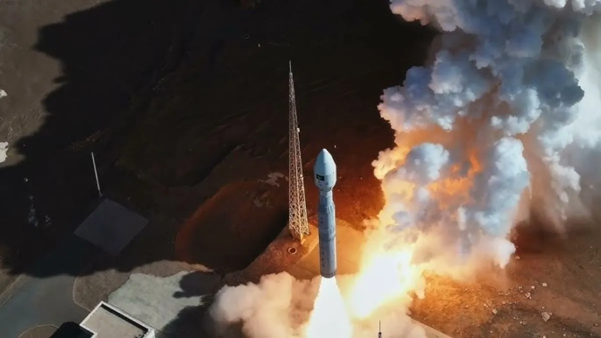
China launched Pakistan's remote sensing satellite, PRSS-2, into orbit on Sunday, the third such mission this year, and further strengthening cooperation between the two nations in space. The satellite was launched together with China's AIRSAT 03 and 04 from Lijian-1 Y8 carrier rocket at a commercial aerospace innovation zone in northwestern China.
Remote Sensing Satellites: Monitoring Earth From Space
PRSS-2 is a remote sensing satellite equipped with sophisticated cameras and sensors for observing and recording the physical attributes of the Earth. It provides crucial data on climate patterns, forest cover, sea surface temperatures, volcanic activities, urban expansion, and farmland conversions. The data is valuable in tracking the environment, natural disaster mitigation, and extended geographical studies. "The launch of PRSS-2 affirms Pakistan's emphasis on applying space technology for environmental monitoring and scientific studies," said a SUPARCO official.
This is followed by prior successful missions in 2025, including PRSS-1 in July and PRSC-EO1 in January. SUPARCO, the space agency of Pakistan, relies heavily on Chinese technology for launch of satellites and technical support because it has never launched a satellite independently. The collaboration in the two-country horizon also includes ambitious missions, and Pakistan plans to send an astronaut to China's space station by 2026 and aims to have a lunar mission by 2035.
Pakistan Planning Minister Ahsan Iqbal emphasized these developments as reflecting Islamabad's growing reliance on Beijing to plug gaps in space technology and infrastructure. China, in turn, has reaffirmed its desire to help Pakistan in its space program, including taking part in the 2028 International Lunar Research Station (ILRS) mission.
Indian vs Pakistan Remote Sensing Satellite Capabilities
Remote sensing satellites are not only meant for scientific and environmental uses but for enhancing a nation's strategic abilities too. Remote Sensing Satellites were reportedly utilised to monitor the deployment of troops along the India-Pakistan border.
• India: Operates high-resolution imaging (up to 0.35m), multi-spectral sensors, and radar imagery EO satellites like RISAT series for border surveillance. India has built military-grade reconnaissance satellites, including EMISAT and ELINT satellites, providing precise electronic and imagery intelligence.
• Pakistan: Fewer satellites like PRSS-1, PRSS-2, and PakTES-1A with optical imagery; resolution and revisit frequency are lower and are largely dependent on Chinese help. Dependent on Chinese launch and technology; no indigenous launch capability or large fleet of high-resolution satellites.
Thus, the successful launch of PRSS-2 marks not only the technological cooperation between China and Pakistan but also the geopolitical importance of space in national development, environmental monitoring, and regional surveillance.