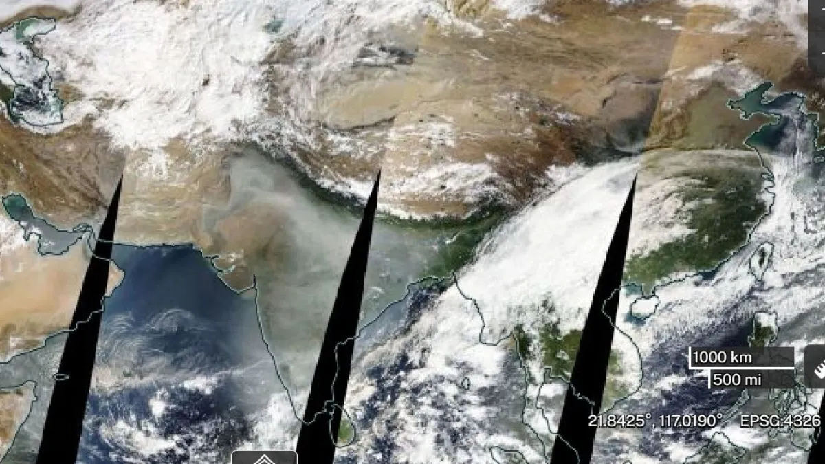
- NASA images show thick haze over India, Pakistan post-Diwali.
- Delhi, Uttar Pradesh among worst-hit regions with alarming AQI.
- Widespread pollution causes health concerns, reduced visibility across region.
Following Diwali celebrations across India, skies were seen blanketed by a thick grey haze of smoke caused by people bursting firecrackers beyond the permitted hours. This contributed to a sharp rise in AQI levels across several states, with New Delhi being among the worst affected.
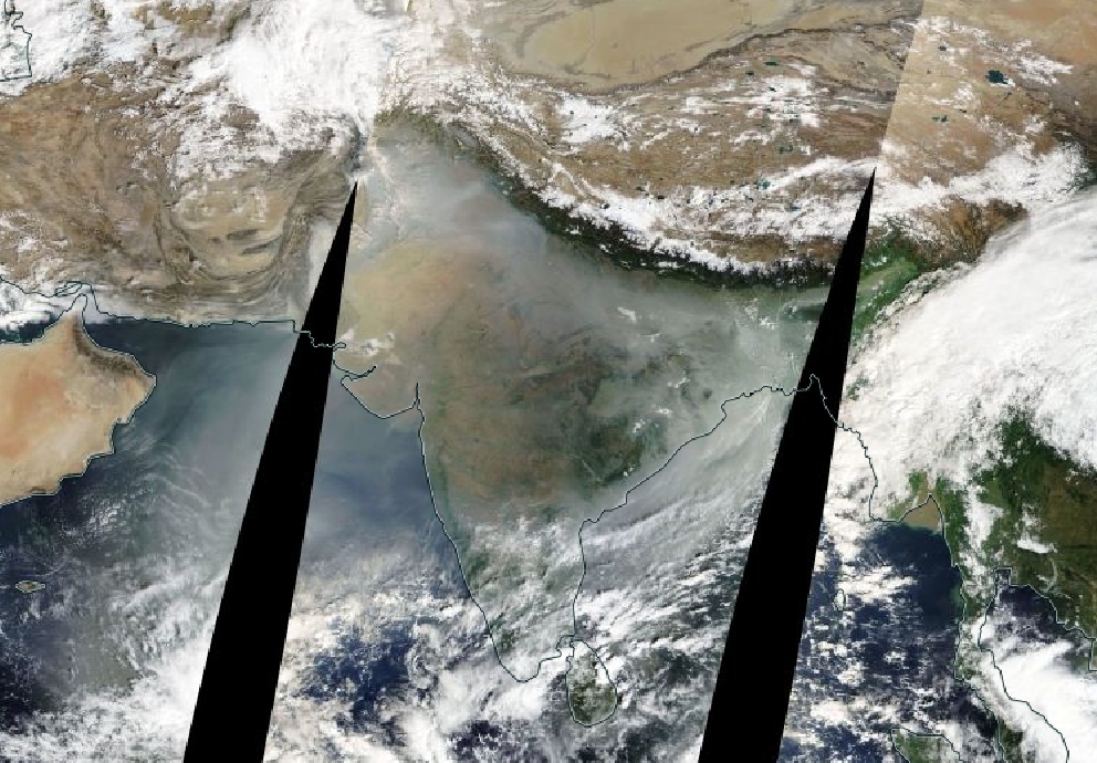
Amid the alarming rise in pollution levels, NASA satellite images have captured the extent of the toxic haze spreading across northern India, revealing a vast blanket of grey covering large parts of the country.
The satellite images also show thick haze extending beyond India's borders into neighbouring Pakistan, indicating that the pollution blanket is not limited to Indian territory. Parts of Pakistan also appear covered in grey haze, highlighting the wider spread of pollution across the region.

( NASA )
The dense haze has engulfed city skylines, reduced visibility on roads and triggered complaints of eye and throat irritation. The deteriorating air quality has raised serious health concerns, affecting people across different age groups.
What Do NASA Satellite Images Show?
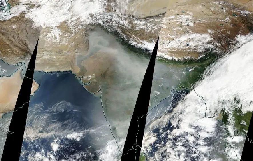
Satellite imagery from NASA Worldview, an interactive web-based mapping and visualisation platform made by the National Aeronautics and Space Administration (NASA), shows large parts of India covered under a thick grey blanket of haze on November 10.
Recommended For You
The haze is thickest over northern India, covering Delhi, Uttar Pradesh and neighbouring states. It also extends towards Himalayan regions, including Uttarakhand, Himachal Pradesh, and Jammu and Kashmir.
( Image credits: NASA )
Central and southern India are also affected, although the haze appears to be less intense in these regions.

( North India covered in thick haze : NASA )
Rajasthan, Gujarat and the northeastern states appear to be among the least affected areas.
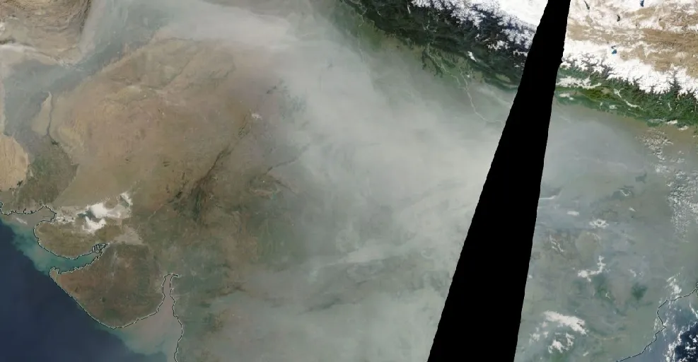
Satellite images also reveal how the haze has changed over the past few days.
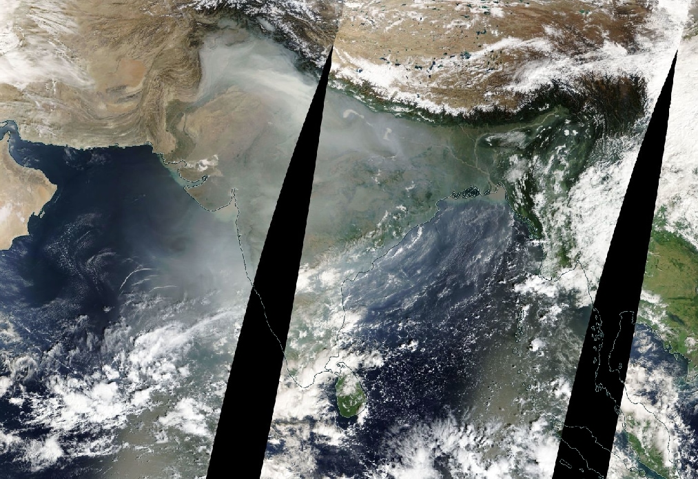 On
On November 8, Diwali day, a dense layer of haze covered Delhi, western Uttar Pradesh and other parts of northern India. On November 9, the haze appeared thinner and more scattered.
By November 9, the haze appeared to have become thinner and more scattered. However, by November 10, it had spread across much wider parts of the country once again.
ALSO READ: Delhi Post-Diwali AQI: Did The Air Get Cleaner Or Worse? What 3 Years Of Data Reveal
Despite these fluctuations, satellite imagery show that haze has persisted over extensive parts of India throughout November, highlighting the continuing challenge of post-Diwali air pollution.
Pakistan Blames India for Lahore's Toxic Air
According to Reuters, Pakistan has blamed pollution drifting from neighbouring India for the deteriorating air quality this week. The allegations come after firecrackers burst during Diwali celebrations over the weekend blanketed large parts of northern India in toxic smog.
Meanwhile, Lahore, in northern Pakistan, topped Swiss air quality monitoring group IQAir's ranking of the world's most polluted major cities for the second consecutive day on Tuesday. The city recorded an Air Quality Index (AQI) of 263, categorised as "very unhealthy".
The NASA satellite images highlight the worsening air pollution situation across India after Diwali. With thick haze continuing to cover several regions, the poor air quality remains a major health concern, highlighting the need for stricter pollution control measures.